WebinarsNew
Explore Business Standard
WebinarsNew
Explore Business Standard
India is ramping up infrastructure on its land frontiers, but major challenges remain
 "Border blitz")
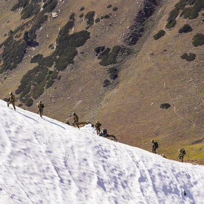
Soldiers patrol a snow-covered mountain at a forward post along the Line of Control, ahead of Diwali in Kupwara district in northern Kashmir, on October 19 (Photo: PTI)
 Premium ContentPremium ContentSubscription ExpiredSubscription Expired
Introducing Blueprint - A magazine on defence & geopolitics
From military strategy to global diplomacy, Blueprint offers sharp, in-depth reportage on the world’s most consequential issues.
annual (digital-only)
₹208/Month
annual (digital & print)
₹291/Month
annual (digital-only)
₹291/Month
annual (digital & print)
₹375/Month

Access to the latest issue of the Blueprint digital magazine
Online access to all the upcoming digital magazines along with past digital archives

Delivery of all the upcoming print magazines at your home or office
Full access to Blueprint articles online
Business Standard digital subscription
1-year unlimited complimentary digital access to The New York Times (News, Games, Cooking, Audio, Wirecutter, The Athletic)
Access to the latest issue of the Blueprint digital magazine
Online access to all the upcoming digital magazines along with past digital archives
* Delivery of all the upcoming print magazines at your home or office
Full access to Blueprint articles online
Business Standard digital subscription
1-year unlimited complimentary digital access to The New York Times (News, Games, Cooking, Audio, Wirecutter, The Athletic)
In this article : line of controlIndia China border row
Next Story