India's navigational satellite sent to orbit
Its provide accurate position information service to users in the country as well as the region extending up to 1,500 km from its boundary
Press Trust of India Joining a select group of nations, India entered a new era in space applications with its first dedicated navigation satellite being successfully put into orbit by its Polar Satellite Launch Vehicle (PSLV), giving the country an alternative to the US’ global positioning system.
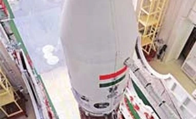
India’s workhorse 44-metre tall PSLV blasted off in a perfect textbook launch at 11.41 pm on Monday night, carrying the indigenous IRNSS-1A from the Satish Dhawan Space Centre in Sriharikota, painting a dense golden flame in the dark canvas of the sky. IRNSS-1A was the first of the seven satellites constituting the independent Indian Regional Navigation Satellite System (IRNSS) space segment, designed to provide accurate position information service to users in the country as well as the region extending up to 1,500 km from its boundary, its primary service area.
An elated Indian Space Research Organisation Chairman K Radhakrishnan said the IRNSS-1A satellite, with a lift-off mass of 1,425 kg, was precisely injected into its intended orbit, 20 minutes after the launch, in the first step for an exclusive navigation system. IRNSS-1A was launched at a cost of about Rs 125 crore, he said.
“This only proves that PSLV is an extremely reliable vehicle and with this flight, we are also entering into a new era of space application in the country that is the beginning of satellite navigation programme,” he said after the launch.
With Isro scientists breaking into celebrations, Radhakrishnan said, “I am extremely happy to announce that we had another excellent flight of our PSLV vehicle. This is the 23rd successive successful flight of PSLV and the fourth successful flight of extended version of PSLV.”
IRNSS will be on the lines of the United States’ Global Positioning System, Russia’s Global Orbiting Navigation Satellite System, European Union’s Galileo, China’s BeiDou satellite navigation system and Japan’s Quasi-Zenith Satellite System.
IRNSS applications include mapping and geodetic data capture, precise timing, visual and voice navigation for drivers, integration with mobile phones and terrestrial, aerial and marine navigation, terrestrial navigation aid for hikers and travellers. It is the first of the seven satellites constituting the IRNSS space segment, with three in geostationary orbit and four in inclined geosynchronous orbit.
IRNSS, which has a mission life of 10 years, has a space and ground segment. The next satellite of the IRNSS-1B series is due for launch in early 2014.
 "India's navigational satellite sent to orbit")