Home / India News / Countdown for IRNSS 1C launch commences at Sriharikota
Countdown for IRNSS 1C launch commences at Sriharikota
The earlier planned launched on October 10 was postponed due to some technical reasons
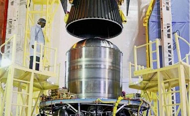
PSLV C26, scheduled to carry the country's navigational satellite IRNSS - 1C, being integrated at Satish Dhawan Space Centre, Sriharikota in Andhra Pradesh. The launch is scheduled at 1.56am on October 10,2014
The 67-hour countdown for the launch of India's navigation satellite IRNSS 1C, the third of seven satellites in the series to put in place India's navigation system on par with US' Global Positioning System, on board PSLV C 26 began today at the spaceport of Sriharikota.
Following the clearance from the Launch Authorisation Board (LAB) yesterday, the countdown commenced at 6.32 a.m today as planned and was proceeding smoothly, ISRO said.
Based on the mission requirements, the launch window is 01:32 a.m to 01:47 a.m (IST) on October 16. The lift-off is scheduled at the opening of the launch window at 1.32 a.m, the national space agency had earlier announced.
The earlier planned launched on October 10 was postponed due to some technical reasons.
IRNSS 1C with a lift-off mass of 1,425.4 kg would be shot into a sub Geosynchronous Transfer Orbit (sub GTO).
As part of its aspirations to build a regional navigational system equivalent to Global Positioning System of the US, ISRO plans to send seven satellites to put in place the Indian Regional Navigational Satellite System (IRNSS).
The first two satellites in the series, IRNSS 1A and IRNSS 1B were launched from Sriharikota on July 1, 2013 and April 4 this year respectively.
ISRO needs to launch at least four of the seven satellites to start operations of the IRNSS, ISRO officials said.
Being developed by India, IRNSS is designed to provide accurate position information service to users in the country as well as the region extending upto 1,500 km from its boundary, which is its primary service area.
IRNSS's applications include terrestrial and marine navigation, disaster management, vehicle tracking and fleet management.
IRNSS is similar to US' Global Positioning System, Russia's Glonass and Europe's Galileo. China and Japan also have similar systems - Beidou and Quasi Zenith.
 "Countdown for IRNSS 1C launch commences at Sriharikota")