Home / India News / Isro's IRNSS-1C launch postponed for a week
Isro's IRNSS-1C launch postponed for a week
India will soon have its own GPS with IRNSS series of satellites
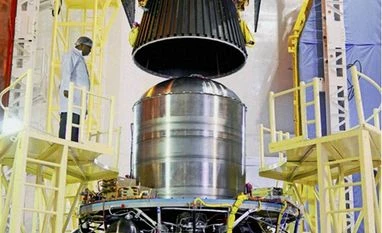
PSLV C26, scheduled to carry the country's navigational satellite IRNSS - 1C, being integrated at Satish Dhawan Space Centre, Sriharikota in Andhra Pradesh. The launch is scheduled at 1.56am on October 10,2014
The Indian Space Research Organisation (Isro) today said that it is postponing the launch of the PSLV-C26 which was set to launch the Indian Regional Navigational Satellite System (IRNSS)-1C by one week.
Isro Chairman K Radhakrishnan said, “This is because of an observation on the performance of telecommand system seen during the launch rehearsal this morning.”
Originally, PSLV-C26 was supposed to lift off from the Satish Dhawan Space Centre at Sriharikota, around 100 kms, on October 10 at 1.56 am.
The IRNSS-1C, the third navigation satellite, would be launched into a sub-geosynchronous transfer orbit (sub-GTO) with a 284 km perigee (nearest point to Earth) and 20,650 km apogee (farthest point to Earth) with an inclination of 17.86 degree with respect to the equatorial plane.
As part of its aspirations to build a regional navigational system equivalent to GPS of developed countries, India is planning to send seven satellites to put in place the Indian Regional Navigational Satellite System (IRNSS). Five things to know about IRNSS
IRNSS will give India its own indigenous air navigation system, which would provide information on location and time in all-weather conditions. IRNSS is similar to the US' GPS, Russia's Glonass and Europe's Galileo. China and Japan too have similar systems — Beidou and Quasi Zenith Satellite System respectively.
IRNSS consist of seven satellites, three in geostationary orbit and four in inclined geosynchronous orbit, and will mainly cover the India and area around it.
The first two satellites in the series, IRNSS 1A and IRNSS 1B were launched from Sriharikota on July 1, 2013 and April 4 this year respectively. The third of the 7 planned satellites, IRNSS 1C is set for launch on October 10 from the first launch pad of the Satish Dhawan Space Centre at Sriharikota. As of now, the IRNSS is a regional system with seven satellites which would be further expanded to 11 satellites in the coming years.
ISRO needs to launch at least 4 satellites to start operations of the IRNSS' applications include terrestrial and marine navigation, disaster management, vehicle tracking and fleet management
'A space-based augmentation system for GPS will make a major difference in the way the airports are operated in India. In the next two years India will have several new satellite based services. Value-added services from the use of navigation will also help the public. Civil aviation would benefit immensely from this endeavour.
 "Isro's IRNSS-1C launch postponed for a week")