Monsoon shows withdrawal symptom from north Rajasthan
IMD official says rainfall will remain weak over northern parts of country in next 4-6 days
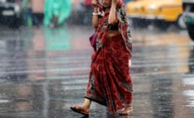
Sanjeeb Mukherjee New Delhi The southwest monsoon has started showing signs of withdrawal from parts of Rajasthan, beginning an end to its four-month journey over the Indian peninsula.
According to senior officials from the India Meteorological Department (IMD), initial signs of withdrawal of southwest monsoon from extreme northern parts of Rajasthan, bordering Pakistan have started arriving. These indicators will, however, take some time to firm up, they said.
“Initial signals have started arriving of withdrawal of southwest monsoon from parts of North-West India, but the parameters need to stabilize in order to establish a firm trend,” D P Yadav, director of India Meteorological Department (IMD), told Business Standard.
He said rainfall will remain weak over northern parts of the country in the next 4-6 days. The southwest monsoon usually starts withdrawing from the parts of Rajasthan around September 1. It gradually moves downwards and the rains cease across the entire country by end of September.
However, since the last few years, the withdrawal of southwest monsoon has been delayed by a week to 10 days. In 2012, rainfall left the country almost 10 days behind its scheduled withdrawal date.
“Withdrawal of monsoon is more difficult to predict than the onset as rains need to cease from a certain area for a fixed period of time, also tendency of moisture build up should also end,” said D.S. Pai, director of Long Range Forecast of IMD. He said a clear picture of withdrawal will emerge around September 15.
September is the last month of the four-month southwest monsoon season that starts from June and gets the least amount of rains.
“In the next 2-3 days, monsoon may start retreading from parts of west Rajasthan because no rains are forecast over most parts of north India in the next 2-4 days,” Mahesh Palawat, chief meteorologist Skymet Weather Services said.
The IMD in its last forecast had said that rainfall in September will be normal. It had also predicted overall total rainfall across the country to be normal at around 98 per cent of the Long Period Average (LPA). Rains between 96% and 104% of LPA, which is the average of last 50 years estimated to be 89 centimeters, are considered normal.
The southwest monsoon entered the Indian mainland on June 1 this year, exactly on its scheduled arrival date.
Its progress thereafter has been one of the best in last many years. The rains not only reached most parts of the country on time, barring eastern India, but were good both in quantum and distribution. The rains have been around 10 per cent more than normal so far since June one.
As a result of this, kharif crops have been sown in around 100.32 million hectares till August 8, which is almost 6.8 per cent more than the same period last year.
Agriculture Minister Sharad Pawar expects foodgrains production in 2013-14 to reach a new record on the back of good rains. Output of grains, pulses and oilseeds are expected to get a big boost because of rains. It will also help sowing of rabi crops, which follows soon after kharif.
 "Monsoon shows withdrawal symptom from north Rajasthan")