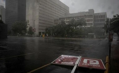
Whole city of New Orleans loses power due to Hurricane Ida
New Orleans, the biggest city in Louisiana, is now without power after powerful Hurricane Ida made a landfall in the US state, local officials said.
)
Explore Business Standard
New Orleans, the biggest city in Louisiana, is now without power after powerful Hurricane Ida made a landfall in the US state, local officials said.
)
New Orleans, the biggest city in Louisiana, is now without power after powerful Hurricane Ida made a landfall in the US state, local officials said.
Sunday also marked the 16th anniversary of Hurricane Katrina's destructive landfalls in Louisiana and Mississippi, reports Xinhua news agency.
"New Orleans has no power. The only power in the city is coming from generators," NOLA Ready, New Orleans' emergency preparedness campaign, tweeted on Sunday night.
Across the coastal state, nearly 870,000 customers have lost power after Ida's landfall, according to latest data from the tracking website poweroutage.us.
The loss of power was due to "catastrophic transmission damage" from the powerful Category four hurricane, said power company Entergy.
New Orleans Emergency Management Services tweeted earlier Sunday it has suspended all operations due to Hurricane Ida.
Heavy rains and strong winds are expected to pound New Orleans Sunday night.
Experts are especially worried about the storm's current slow movement, sustained power and direction, according to local media reports.
New Orleans has spent $14 billion to upgrade its flood protection system after heavy suffering from Hurricane Katrina 16 years ago, according to a USA Today report.
However, facing the threat of Ida, Deputy City Administrator Officer Ramsey Green has warned that "it's an incredibly fragile system. That system can change at any point".
Ida made landfall in Louisiana on Sunday afternoon and was downgraded to a Category three later in the evening.
However, the risk remains high since Category three storms generally have sustained winds of 111 to 129 mph, and the damage they cause can be devastating, the National Hurricane Center (NHC) said on its website.
"Well-built framed homes may incur major damage or removal of roof decking and gable ends. Many trees will be snapped or uprooted, blocking numerous roads. Electricity and water will be unavailable for several days to weeks after the storm passes," the NHC said.
Ida grew into a Category four storm within hours early Sunday morning, hours before its landfall.
The so-called "rapid intensification" is typically defined to be a tropical cyclone intensifying by at least 35 mph in a 24-hour period, according to Colorado State University meteorologist Phil Klotzbach.
That can happen when a storm encounters an extremely conducive environment such as very warm water, low vertical wind shear and high levels of mid-level moisture, Klotzbach told local media.
--IANS
ksk/
(Only the headline and picture of this report may have been reworked by the Business Standard staff; the rest of the content is auto-generated from a syndicated feed.)
First Published: Aug 30 2021 | 3:42 PM IST