Isro's satellite images show damages caused by earthquake in Myanmar
Isro released the images captured by its earth imaging and mapping satellite, CARTOSAT-3 -- a third generation agile advanced satellite having high resolution imaging capability
 "Myanmar earthquake")
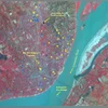
Satellite images released by Isro shows damage caused by earthquake in Myanmar. (Photo: Isro)
Listen to This Article
The Indian Space Research Organisation (Isro) has released satellite images showcasing the damages caused by the devastating earthquake in Myanmar, which has resulted in over 2,000 deaths.
The 7.7 magnitude quake hit Myanmar on March 28, with the epicentre near the second-largest city of Mandalay. It was followed by a series of aftershocks, which damaged the city's airport, buckled roads and collapsed hundreds of buildings along a wide swath down the country's centre.
Isro released the images captured by its earth imaging and mapping satellite, CARTOSAT-3 -- a third generation agile advanced satellite having high resolution imaging capability. The post-earthquake imagery was acquired by Isro on March 29 over the cities of Mandalay and Sagaing in Myanmar. The pre-event Cartosat-3 data acquired on March 18 covering the same area was referred for change analysis and assessment of damage, the space agency said.
Photo: Isro
Also Read

 "S Somanath, Somanath, ISRO Chairman")
 "ISRO")
 "GSAT-18 successfully launched by Ariane-5 VA-231 from Kourou, French Guiana. (Photo: Twitter/@isro)")

"Significant damage to infrastructure in Mandalay city was observed, with major landmarks such as Sky Villa, Phayani Pagoda, Mahamuni Pagoda and Ananda Pagoda, University of Mandalay and several others suffering either complete or partial damage. In Sagaing city, damage was observed in the Ma Shi Khana Pagoda, along with several monasteries and other buildings," the Isro said.
Photo: Isro
The satellite imagery showed the complete collapse of the historic Ava (InnWa) Bridge on the Irrawaddy River near Inn Wa City. Cracks, ground ruptures in flood plains of Irrawaddy river with associated liquefaction was also observed.
Isro noted that the earthquake caused significant damage to cities of Mandalay, capital Naypyidaw and other regions, resulting in the collapse of infrastructure, roads and residential buildings.
"The tremors were felt not only in Myanmar but also in neighbouring countries. The shockwaves were strong enough to be felt as far as Chiang Mai and northern parts of Thailand, where residents reported damages," the space agency said.
 "Parliament, New Parliament")
 "Train derailed, Mathura train derailed")
 "Pushkar Singh Dhami,Pushkar Singh,Pushkar")
 "Chile's President, Gabriel Boric")
 "Union Minister of Ports, Shipping and Waterways Sarbananda Sonowal")
Don't miss the most important news and views of the day. Get them on our Telegram channel
First Published: Apr 01 2025 | 10:15 AM IST