Isro's NavIC down to 3 satellites: What it means for India's GPS ambition
India's indigenous satellite navigation system NavIC faces fresh reliability concerns after IRNSS-1F's atomic clock failure, raising questions about the resilience of the country's navigation constell
 "Satellite, Telecom industry, Department of Telecom, TRAI, AGR, Telecom Regulatory Authority of India")
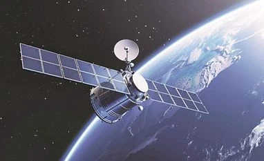
Like the GPS, NavIC provides positioning, navigation and timing (PNT) services using signals transmitted by satellites. (Representational Image)
Listen to This Article
During the Kargil war in 1999, the Indian government approached the US seeking global positioning system (GPS) data for the region to check Pakistan’s aggression. However, the US declined New Delhi’s request, maintaining that it would not assist either side in the conflict. This prompted India to build an indigenous navigation system for strategic autonomy in positioning and timing services, especially during emergencies or conflicts.
In 2013, the first satellite of the IRNSS (Indian Regional Navigation Satellite System) was launched with an aim to build India’s own version of GPS. A decade later, IRNSS, which is now called NavIC (Navigation with Indian Constellation), faces reliability concerns.
On March 13, 2026, the Indian Space Research Organisation (Isro) said the atomic clock of one of the remaining satellites in orbit had stopped working. In simpler terms, it means the system will not be able to provide reliable navigation data.
Here is what you need to know about the NavIC system, what it does, and what problem it is facing today.
Also Read

 "US green card")
 "Ali Larijani")
 "UAE, Iran war")
 "Ali Larijani")
 "Rains, New Delhi Rains, Delhi rains")
What is NavIC and how does India’s satellite navigation system work?
Like the GPS, NavIC provides positioning, navigation and timing (PNT) services using signals transmitted by satellites. Receivers on Earth calculate their location by measuring how long these signals take to travel from the satellites.
NavIC is designed as a regional system, covering India and roughly 1,500 km beyond its borders, rather than offering worldwide coverage like GPS.
The system provides two types of services:
- Standard Positioning Service (SPS): available for civilian use
- Restricted Service (RS): encrypted signals intended for authorised users, including the military
The project was approved by the Government of India in May 2006. The first satellite, IRNSS-1A, was launched aboard PSLV-C22 on July 1, 2013. Over the next three years, Isro steadily deployed additional satellites through a series of PSLV missions.
The constellation was completed with the launch of IRNSS-1G on April 28, 2016. Following this milestone, Prime Minister Narendra Modi named the system NavIC.
Where is NavIC used in India today?
NavIC is used across public and government agencies. Key applications include:
- Transportation and vehicle tracking
- Defence and strategic operations
- Disaster management and emergency response
- Agriculture and surveying
- Telecommunications and timing services
Which countries operate satellite navigation systems like GPS?
India is among a small group of countries that operate their own satellite navigation systems.
Besides the US’ GPS and India’s NavIC, Russia operates GLONASS, Europe runs Galileo, and China operates the BeiDou Navigation Satellite System (BDS). These three systems, like GPS, provide global coverage with constellations of around 24–35 satellites in medium Earth orbit.
China’s BeiDou has more than 30 operational satellites, while Europe’s Galileo offers high-precision civilian positioning services worldwide.
Compared with these global systems, NavIC has only seven satellites and is designed for regional coverage, focusing on high accuracy over the Indian subcontinent rather than worldwide navigation.
What is an atomic clock in navigation satellites?
Every navigation satellite carries atomic clocks, which are extremely precise timekeeping devices.
Satellite navigation works by measuring the time taken by radio signals to travel from a satellite to a receiver on Earth. Because radio signals travel at the speed of light, even a tiny timing error can produce a large error in the calculated position.
Atomic clocks use the natural oscillations of atoms, typically rubidium or caesium, to keep time with extraordinary accuracy.
Why atomic clock failure affects satellite navigation systems
If the atomic clocks on a satellite fail, the satellite can no longer provide precise navigation signals.
Several NavIC satellites have suffered such failures since 2016, when all three atomic clocks aboard IRNSS-1A stopped functioning.
When this happens, satellites may still be usable for one-way communication or messaging services, such as broadcasting disaster alerts to fishermen, but they cannot support accurate positioning.
The latest affected satellite is IRNSS-1F, launched in March 2016. It has now reached its design life, and its atomic clock has stopped functioning.
Notably, NVS-02, a new-generation NavIC satellite launched in January 2025 to replace one of the older satellites, was also unable to reach its final orbit.
What IRNSS-1F’s failure means for NavIC
Satellite navigation systems require at least four satellites visible at a time to determine a receiver’s precise position.
With the loss of IRNSS-1F’s clock and earlier problems affecting other satellites, the NavIC constellation currently has fewer satellites capable of providing fully reliable positioning services.
This means reduced reliability of NavIC positioning services and greater dependence on foreign navigation systems such as GPS.
What next for NavIC and India’s navigation ambitions?
Isro has begun deploying second-generation NavIC satellites (NVS series) designed to address earlier problems.
Key improvements include indigenous atomic clocks and reduced dependence on imported components. Earlier, the atomic clocks were sourced from European firms such as Switzerland’s SpectraTime.
The NVS series satellites also support the L1 frequency band, which helps smartphones, vehicles and other receivers determine their location and time accurately using satellite signals.
More satellites in the NVS series are expected to be launched to restore the constellation and improve redundancy.
More From This Section
 "SC, Supreme Court")
 "Oil, Oil tankers, Oil tanker trucks")
 "Rajya Sabha")
 "Parliament, New Parliament")
 "Western Ghats (Photo: Wikipedia)")
Topics : ISRO Isro NavIC ISRO navigation satellite Navigation satellite BS Web Reports GPS in phones
Don't miss the most important news and views of the day. Get them on our Telegram channel
First Published: Mar 16 2026 | 5:24 PM IST