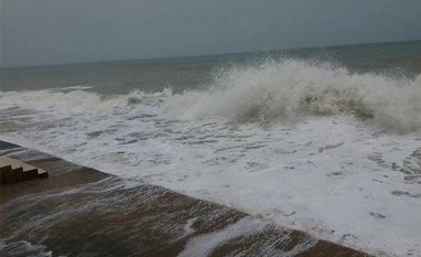
Low pressure area forms in Bay of Bengal, to intensify into cyclone: IMD
A low pressure area has formed in the Bay of Bengal on Thursday, and is likely to intensify into a cyclonic storm over the next four days, the India Meteorological Department (IMD) said.
)
A low pressure area has formed in the Bay of Bengal on Thursday, and is likely to intensify into a cyclonic storm over the next four days, the India Meteorological Department (IMD) said.
The low pressure area, which has been formed over southeast and east-central Bay of Bengal, is likely to deepen into a depression by October 22 and into a cyclonic storm by October 24.
"Under the influence of the cyclonic circulation over north Andaman Sea and its neighbourhood, a low pressure area has formed over north Andaman Sea and adjoining areas of south Andaman Sea and southeast Bay of Bengal with the associated cyclonic circulation extending up to 7.6 km above the mean sea level," IMD said in a statement.
"It is very likely to move west-northwestwards and concentrate into a depression by October 22 over central and adjoining southeast Bay of Bengal. It is very likely to intensify further into a cyclonic storm over westcentral Bay of Bengal during the subsequent 48 hours," it said.
Meanwhile, the Odisha government has put the administrations of seven coastal districts on alert in view of the IMD's forecast of a possible cyclone.
Also Read
The districts that may be affected are Ganjam, Puri, Khurda, Jagatsinghpur, Kendrapada, Bhadrak, and Balasore.
Authorities have been asked to remain alert and closely monitor the situation.
The weather office has also predicted heavy rainfall in Puri, Kendrapada, and Jagatsinghpur districts on October 23.
The weatherman, however, has not predicted the intensity, path and wind speed of the system, which is likely to bring heavy rain in coastal Odisha.
(Only the headline and picture of this report may have been reworked by the Business Standard staff; the rest of the content is auto-generated from a syndicated feed.)
More From This Section
Don't miss the most important news and views of the day. Get them on our Telegram channel
First Published: Oct 20 2022 | 12:57 PM IST

